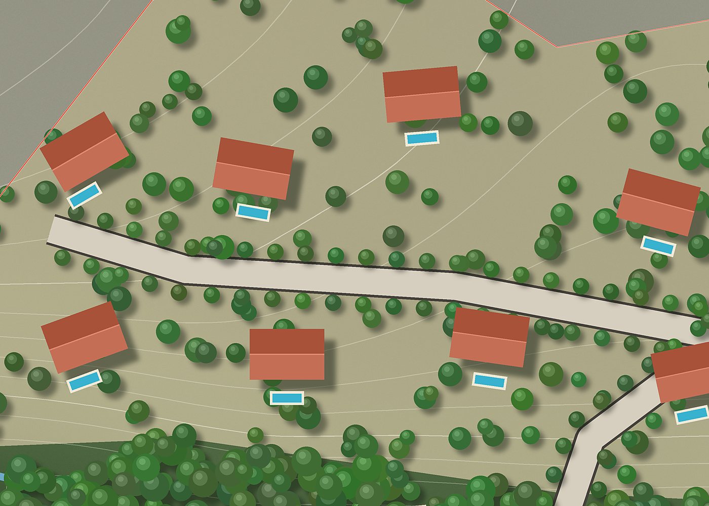
Type the bearings or trace the PDF. Siteplan draws your boundary to scale, lays it on the real terrain and gives you the tools to zone the land and place every building where the ground suits it.
Bearings · PDF · photo · KML · coordinates → plan · terrain · 3D
Survey planBearings, distances and beacons, as your surveyor drew them.
Boundary to scaleLegs typed or traced, misclosure checked, placed in UTM.
Real terrainElevation, slope, contours and drainage under the boundary.
Zoned by the landUses drawn where the ground suits them, areas counted live.
Buildings to scaleReal footprints, with the fall across each one and its setback.
Scroll or drag
1 PDF
A surveyor's plan, a photo of it, a KML or beacon coordinates is all you need
±4 m
Terrain heights checked against on-site GPS in testing
1 link
Opens in 3D on any phone, nothing to install
7
Drawing types, from location plan to 3D aerial, ready for planners
How it works
Survey in. Site plan out.
Three steps, all in the browser. No CAD licence, no GIS training, nothing to install.
01 · SURVEY
Bring your boundary
Type the bearings and distances off your plan, trace a PDF or photo and set its scale from one known leg, or paste beacon coordinates. KML and GeoJSON work too.
8 legs · closes to 0.004 m
1 in 236,000 · 16.34 ac
02 · TERRAIN
Read the land
Real elevation loads under your boundary: hillshade, slope bands, contours and a map of where the ground is high and gentle, where water collects and what's too steep.
123 → 132 m · mean slope 3.8%
profile A–B: steepest 11%
03 · DESIGN
Zone it and build it
Draw zones and watch areas update in m², hectares, acres and plots. Drop buildings at their real size. Subdivide into plots. Look at it in 3D. Export.
Villas 1.91 ha · 29% of site
212 plots of 500 m²
Every decision, measured
Put the house where the ground agrees.
Select anything and the inspector tells you what the land is doing underneath it: how high it sits, how much the ground falls across it, how close it is to the boundary.
Villa · fall across 0.8 mSteep · keep naturalPerimeter road · 9 m
Inspector · Villa
Footprint22 × 16 m · 352 m²
Ground level131.4 m
Fall across0.8 m
To boundary14.2 m
Ground is fairly level here.
Inspector · Zone
Area1.91 ha · 4.72 ac
Plots34 of 500 m²
Mean slope4.2%
Gentle ground: good for building.
The tools
A drawing board that knows the terrain.
Everything a landowner, architect or surveyor needs to go from a survey plan to a site plan they can defend.
Bearings & distances
Type the legs off your plan. Siteplan closes the traverse, reports the misclosure and spreads it across the legs.
Survey
Trace any plan
Drop in a PDF or a phone photo, rotate it upright, click the beacons and set the scale from one leg you know.
Survey
Terrain layers
Hillshade, slope bands and contours at 1, 2, 5 or 10 m. Hover anywhere for height and slope.
Terrain
Elevation profiles
Draw a line across the site and see the section: rise, fall and the steepest stretch.
Terrain
Where to build
One overlay shows high, gentle ground, hollows where water gathers, and slopes to leave green.
Terrain
Zoning, counted live
Sixteen land uses, from housing to lawns and paving. Every zone shows its area in m², hectares, acres and plots, and its share of the site.
Design
Buildings to scale
Houses, villas, apartments, pools, courts and barns at real sizes. See the fall across each footprint and its setback.
Design
Plots, 3D & export
Subdivide a zone into plots with roads, orbit the plan in 3D over satellite imagery, export drawings and CAD files.
Design
Who it's for
Anyone holding a survey plan.
For anyone with a survey plan and a piece of land, anywhere. The survey is the record everyone has; a site plan is the thing almost nobody can make for themselves.
Landowners
Family land, farms, a plot bought from abroad: see what it is and what it can hold.
Architects & planners
Start the concept on real terrain in minutes, not after the topo survey arrives.
Surveyors
Hand clients a site plan alongside the survey. Show them the boundary on the ground.
Developers
Test layouts, plot yields and road lengths before you commit.
Students & teachers
Learn traverses, contours and site planning on real land.
Pricing
Free to design.
The studio is free while in beta. Paid plans add cloud projects, sharing and the tools teams need.
Pro and Developer are coming soon. Launch prices, subject to change.
Questions
Plain answers.
Is this a legal survey?
No. Siteplan works from the survey you already have and helps you design with it. Boundaries, title and setting-out on the ground still need a licensed surveyor.
What do I need to start?
Your survey plan. If it lists bearings and distances, type them in. If not, upload the PDF or a clear photo and trace it. Coordinates for one beacon (printed on most plans) let Siteplan place the site on real terrain.
How accurate is the terrain?
It comes from open global elevation data, which in our tests matched on-site GPS heights to within about 4 metres. That's enough to see ridges, hollows and slopes and to plan sensibly. For engineering design, use a detailed topographic survey.
Where is my work saved?
In your browser, as you work. Export a project file to keep a copy or move it to another computer. Cloud projects come with Pro.
Does it work on a phone?
You can view and explore plans on a phone. Designing is best on a laptop or desktop with a mouse or trackpad.
Which coordinate systems does it support?
Every UTM zone, north and south, plus latitude and longitude, so it works for sites anywhere in the world. National grids are on the way.
Start now
Your survey plan is one step from a site plan.
Open the studio and start drawing, free. Or leave your email for Pro and Developer updates.